Thursday, November 27, 2008

Upwelling and sea life


Upwelling, is an oceanographic phenomena where wind driven currents in the ocean are overturned causing the warmer and nutrient deficient surface waters to be replaced by colders and nutrient rich waters. The first diagram shows the how the process occurs and the second is a map of the world where upwelling occurs, which there is a direct relationship with the coasts.


More importantly there is an abundance of life in this area as the nutrients rich environments provide energy for all the creatures in the area. They are sights of great activity.


Cnidaria


I've always found this phylum super interesting. Cnidaria is a divese phylum of animals. Some members of this group are not thought of animals by some members of the general public such as corals, or Anthazoans. This phylum also includes the jellyfish, or scyphozoans. I find this amazing that corals are relatively closely related to Jellyfish.
The word Cnidaria is a derivative of the Greek word 'cnidos' meaning stinging needle. Most of members of this phylum have some sort of defense mechanism that is centred around having these stinging needles. As a phylum they are really interesting and beautiful.

Wednesday, November 26, 2008

Blue footed Boobies!


By far my favorite bird species that I know exists is the Blue Footed Booby (Sula nebouxii). This species has blue feet, lives primarily around the Galapagos Islands and has one of the craziest bird dance ever. From a biological perspective it is an example of pre-zygotic isolation which basically means it prevents other viable species from mating with these species thereby keeping this species alive. The booby dance is famed all around the world. Most importantly to this course however is the fact that they live off ocean fish and squid. They usually feed close to the coastline and can feed in groups that contain more than 1000 individuals. There is plenty of videos showing this feeding frenzy and it is an amazing site indeed. I just don't know how to post footage from youtube. they are really great birds and worth the research time.
here a nice link to more information about the bird.


Harmful Algal Blooms


Red tides are not tide related at all and as it turns out the term is being phased out and replaced with the more accurate term algal bloom. Blooms of phytoplankton occur near the surface of the water giving the water in which the bloom occurred its red colour. From what I read the red colour is due to a red pigment contained in certain phytoplankton species.
Red tides can be toxic to many organisms including homo sapiens sapiens. This occurs because the toxins contained in the algal blooms can move into the food web and thus creating toxins found in all parts of the web. There are various syndromes associated with eating foods contaminated by harmful algal blooms and for more information go to this website.


Saturday, November 22, 2008

Smooshie!


One of my early childhood friends from 'home' had an interesting saga with a walrus. He is a trainer at Marineland in Niagara Falls Ontario. One of the walruses took a liking to him which attracted a lot of media and research attention. His story spawned alot of reasearch into imprinting capabilities of animals after they had a relatively stressful experience. One should check out his myspace site for more information. The last time I spoke to him Smooshie had been returned to live with the rest of the seals at the facilities because smooshie is now fully grown up. Anyways, I just thought this was a nice little post to put...somehow related to ocean creatures.

Elephant seals


Last months National Geographic had a short story about elephant seals which inspired this blog post. Apparently there are about 700 000 individuals in the circumpolar arctic ocean. Amazingly they can dive 3 200 feet. And I read in the national geographic article that they are starting to put cameras and ocean monitoring equipment that will help researchers understand more about ocean currents under the Antarctic sea ice which is amazing.


Male elephant seals can reach the four tonnes mark which is more than a small car. Beachmasters are a term given to male bulls whom have fought and won breeding rights to whomever lands on their beach. Sometimes beachmasters can have a harem of over 50 cows.These are really great animals living in some of the harshest climates on earth. I found some of the information from this article.

Wednesday, November 19, 2008

NEKTON Debate

This is a little post contrasting what we told in class. Nekton nekton, those creatures that move freely from currents, as opposed to plankton which move with currents. Nekton does in fact include all the vertebrates, that is the fish and sharks and whales and seals and and and all the creatures that may swim freely in the ocean. I guess it is just a catch all term. For more information go here.

Swim Bladder


One of the ways fish swim down to great depths is to use swim bladders, or gas bladders. These are basically air sacs located within fish to help them regulate their boyancy. The question becomes how does that help anyways?
Oxygen is much more plentiful in the atmosphere than in water. On average there is 210 cubic centimetres of oxygen in one litre of air compared to 10 units in water.
Swim bladders help fish dive to great depths and return to the surface. Some fish must inflate their swim bladders from the atmosphere and others can inflate it by diffussion of oxygen from their lungs. I wanted to quickly look at the evolutionary history of this fish and I found this interesting article that states swim bladders from fish that use the oxygen method to control buoyancy are all related. This means the evolution of this type of method evolved just once. So this is my little post. If you're dying for more biology related information go here.


The earliest fishes, as well as modern cyclostomes, sharks and rays all live without a swim bladder.

Saturday, November 15, 2008

Seiches


This phenomena is basically a standing wave in an enclosed/partially enclosed body of water. It can seem to be lunar tidal related but I don't think it is. This phenomena is equivalent to the sloshing of water in a bathtub and there is a nice diagram explaining the phenomena here. It is basically the sloshing around of water in an enclosed area due to prevalent winds pushing water in one direction. Once the wind stops blowing the water returns from the direction it came from. The movement can seem tide like but it isn't directly related to the sun or moon, such is the case with neap and spring tides. As always, there is more information available from wikipedia.

Lunar Tides


Tides are basically the rise and fall of the sea surface relative to land. They are basically produced by gravitational forces from the Sun and the Moon. Two major lunar tide types are Spring Tide and Neap Tides. The NAOO has a nice little diagram of how both occur. Spring tides occur when the moon is full/new and the gravitational pull of the sun are combined. Neap tides occur when the moon and sun are at right angles of each other. The end result is that Spring tides have higher highs and lower lows and neap tides are less intense tides. Check out this site for more information.

Thursday, November 13, 2008

HARBOUR WAVE!!!!!!!!!!!!!!!!!!!!!!!!!!


Harbour waves don't bring up the same mental imagery of a TSUNAMI but they mean the same thing. I also found the Canadian Geographic website, which has a great article about tsunamis and how they form. It also has air photos of before and after a tsunami struck. I just don't know how to link these into this blog thing.
I find the article interesting because it points out that the mental imagery of a tsunami is not really the same as the real thing. Tsunamis are not a single huge wave engulfing our coasts.
Tsunamis form by earthquakes or some other cataclysmic event that allows water to rise. In open oceans tsunami waves are barely visible, sometimes being no more than a meter or so high. They don't get dangerous until they hit the coast and it is the shallowing of the land near the coast that makes a tsunami bigger and consequently more dangerous.
That is my lesson for the day.Make sure to check out the photo's!

Tuesday, November 11, 2008

Octopus Origins


Found this article in the Globe and Mail that was pretty interesting. It says that the deep sea waters of Antartica's Southern Ocean is the home of most of the world's deep sea octopus. So I guess we can say that deep sea octopus had this out of antarctica movement that had occurred some 30 million years ago.
What is interesting that Canadians are involved in this. One researcher is from Memorial University, located on The ROCK.

Great little discoveries like this make my day so much brighter

Thursday, November 6, 2008

Tsunami Institute


Following our class discussion on Tsunamis, I found this website of the Tsunami Institute. It has some pretty interesting pages like Tsunami Formation. The diagram shows the tectonic influence in tsunami formation. There is also a really nice section on Tsunami Occurence which shows a map of tsunamis from a world wide perspective. You can even subscribe, for a price!, to their Tsunami Alarm System which will send you a message via satellite if a Tsunami were to strike. The important thing though is that as we learned in class there must be a tsunami detection system in place for this to work.

Friday, October 31, 2008

Pollution in the Bay

Here is a quick post about pollutants in the Bay of Fundy. This website says that it is because of the 'flushing' effect of the Bay of Fundy combined with the low population densities found around the Bay that contribute to it being relatively clean. The take home point is the word relative. It is not to say the Bay is pristine but it is relatively clean. Relatively clean means that the Bay has 2-5ppm of PCB's conmpared to 9-10PPm of PCB's found in the St. Lawrence estuary. I still think that 2-5ppm is alot but I'm no expert on the subject. I just think this is enough for me to stay away from sea food as a whole but to each their own. Pollution to me is more than about impacts to humans and animals of this generation. It is a legacy that we leave to those that come after us and if nothing else we should think of what sort of message we are sending out to those future generations.

I've found a nice website regarding sea ice circulation in the North. The website shows the major patterns of Arctic circulation. What I wanted to know was how fast does this current move and apparently the answer is that sea ice caught in the Beaufort Gyre will be caught up in the north for several years. I wanted to know how fast pollution reaches the arctic and found that there is one main entry point to the Arctic Ocean and that is through the Northeast Atlantic area.
However I wasn't able to find how quickly pollutants travel from America to the Arctic via ocean currents. Anyone have any information on this?

Nova Scotia and Manitoba...


Here is another quick post about the endangered and threatened aquatic species in Canada. Habitats are key to the survival of any species and Nova Scotia seriously lags behind other provinces in this department. Nova Scotia and Manitoba are the only Canadian provinces that do not have Marine Protected Areas which I think is unacceptable as Canadians. I hope we can do something about this soon.

Canadian shark research


Following the presentation in class regarding sharks I've put a quick link to the Canadian Shark Research Laboratory headed by Dr. Steven E. Campana. They have been active since 1994 and gather biological data used to give general health and stock assessments of shark populations within Canadian waters. I think it is great that we have this kinda research. Apparently, there are limited and competitive research opportunities. I think this would be really great to get an opportunity to do some of this research for masters work. However, it is not only about being outdoors hunting sharks there is alot of laboratory work involved and that can be tedious but it would still be a great experience.

Wednesday, October 29, 2008

Gulf Stream


Visually stunning images of the Gulf Stream are all over the internet. Which I tend to do sometimes when I should be doing other things.
It is great to see the eddies forming. This is the stream that keeps England warm as a opposed to the freezing temperatures seen at the same latitude of other countries.


I know there is alot of research being done right now to try to determine the changes that are occuring with the Gulf Stream, a topic that lies beyond this blog post. I just wanted to show the eddies as they exist today, which this last one is a 3D image of the stream.


Saturday, October 25, 2008

Langmuir Circulation


Basically, Langmuir Circulation are visible in those little streaks of bubbles or floating material that collect on the top of ocean surfaces. The formation was first discovered in 1938 by Irving Langmuir. Basically, two adjoining cells of water rotate in opposite directions, forming converging bands of water where bubbles and floating material meet. They are associated with upwelling regions of the ocean. As the diagram shows, floatsam(ocean debris) and bubbles collect at these location. I wish I had more to offer but i've got to run and this was a needed little piece of information that I needed to post.

Laird Hamilton- the big wave king

This is a quick post about Laird Hamilton, the guy whom invented tow-in-surfing.Riding giant waves like Jaws outta Hawaii. Amazingly, this guy was born in a bathysphere in 1964. He has taken on the biggest waves and the world and has lived to tell about it. I could never do what he does but it is deserving of a post due to the topic of water circulation that we've covered in class.
I don't know how to put youtube posts on this blog thing so i'll just give you some links here and here

Ekman transport


Here I'm putting another post about ocean currents. This time is is about the Ekman transport. Wind moves water, which is pretty evident, but I didn't realize that Fridtjof Nansen, the guy whom stuck his boat into the ice to prove his theory that polar ice did flow, taught Vagn Ekman, the guy whom first describe what we know as the structure called the Ekman spiral and the event known as the Ekman Transport.
The Ekman spiral tells us that the direction of water movement changes with increasing depth. It is a deflection process where each moving layer is deflected to the right of the overlying layers movement. This has to do with the Coriolis force and its deflecting properties. Ekman transport is the coupling between wind and surface water. I think it forms the basic structure of gyres.

Western intensification


Ocean currents are complex to say the least. In this post I'll briefly talk about Western Intensification which is basically the intensification of the western parts of ocean currents. This process is a wind driven phenomenon caused in large part due to the Coriolis Effect. Basically, the trade winds apply a stress to the ocean winds. Once the continents play a role there is a tendency for poleward movement to occur. This process explains why the gulf stream is more intense on its western side than the eastern one.

Saturday, October 18, 2008

Linda Greenlaw


This is a quick post about one of the amazing women in history and captains of our time, Linda Greenlaw. She is a writer but more importantly the captain of the sword boat that led to her having a prominent role in the movie The perfect storm. More recently, the world famous fisherwoman, was arrested just of the coast of Newfoundland for illegal fishing within the Canadian 200 mile limit. Apparently at the time of her arrest they were filming for a movie which is to air at some point on NBC, or something (I haven’t had a TV in quite a few years so I’m not really up to date on that sort of stuff).
Anyways, this is my quick post about an interesting person in life.

Friday, October 17, 2008

The Gully


Located some 200 km off Nova Scotia, on the edge of the Scotian Shelf lies a sea canyon called The Gully. The gully is approximately 2 km deeper than the Scotian Shelf. It was formed thousands of years ago by erosion of the shelf at a time when sea levels were much lower. The Gully is 65 km long and 15 km wide making it the largest, or one of the largest, sea canyons on the eastcoast of North America.
Home to a wide range of creatures, the list is much to big for me to put here but the important thing is that it is a marine protected area. I tried to find more information on this and maybe a few pictures but this didn't prove fruitful in the short time I tried to do it. So if you have any interesting links or images send them to me. Cool area right off the coast of New Scotland!


Wednesday, October 15, 2008

Antarctic Bottom Water!


The southern hemisphere is said to have the densest water but why is that?
It all has do to with understanding water density, as was briefly mentioned in my last post. Density of ocean water is a function of temperature and salinity. The more saline the water the more dense it is. The colder ocean water the more dense it is. Evaporation makes the water more saline and thus more dense and as a result will sink to the ocean bottom. Sea ice, which does not take up salts, makes the water more saline and thus more dense.
So what does this have to do with the southern ocean density?
Well, the freezing sea ice located in Antarctica, the coldest part of the planet, increases the salinity of the cold water forming a mass of extremely dense water. This occurs in the Weddell Sea, located off Antarctica, and forms what is known as the Antarctic Bottom water.

The final reason why the antarctic is more saline is that in the North Atlantic saline water cools and sinks to a moderate level to form the North Atlantic Deep Water, which eventually flows south and due to the fact that it isn't as dense as the Antarctic Bottom Water it actually flows to less depth relative to the situation in the southern hemisphere.
Geography rocks!
My source for this post.

Tuesday, October 14, 2008

Pycnocline


So apparently the water density of the ocean is about 1027kg/m3. Two main factors affect water density : temperature and ocean salinity. As temperature decreases density increases, which makes sense because usually colder things are more dense.
The fact that there is difference in density means that less dense water floats on top of more dense water...pretty straight forward stuff. However, temperature has a greater effect on water density than salinity so that a more salty layer of water can actually float on top of a less salty layer...which is kinda amazing phenomenon. Temperature of the ocean water decreases with depth so there is a horizontal temperature gradient to ocean water. A pycnocline is a rapid decrease of density with depth. The image shows a picnocline which I got from here.

Saturday, October 11, 2008

Hydrothermal vents


These places deep in the ocean floors were once thought to be oceanic deserts but now we are realizing that they are home to an increadible divesity of life. They also provide us with some fantastic images. This website gives a good overview of what hydromal vents are all about.


The Fram


This post is a quick one dedicated to arguably one of the most interesting polar explorers that ever was :Fridtjof Nansen. This simple post merely outlines his most famous expedition. In 1893, Nansen set out to explorer arctic ice drift. He basically built himself a boat called the FRAM(pictured above), which was later used by Roald Amundsen- the guy who first made it to the south pole. He basically froze his boat into ice drift for three years to test his theory of ice drift in the North Atlantic and Arctic. There is
a pretty cool map of his voyage here.
It must be said that he did all this during a time when it still wasn't sure if the Arctic was made of land, sea or ice. And it was his contributions that helped us learn a little bit more about the polar regions.
For more information regarding Nansen check out this website.

Friday, October 10, 2008

The smell of the sea


Surprisingly, the smell of the sea doesn't only come from the salt from the ocean blowing in the air alone. It also comes from a marine plants and algae doing their photosynthetic thing while drifting in the upper waters of the ocean. Through this process of photosynthesis the marine plants and algae produce a compound known as dimethylsulfide or DMS.
DMS is therefore a biogenic gas ( bio meaning"living", genic meaning "produced by").
Apparently the gas was discovered around 30 years ago and has since been extensively studied for its contributing role in the global climatic system.
DMS controls and contributes to climate in playing a directive role in the global radiation balance. It does this by contributing to the condensation nuclei concentration in the air needed to form clouds. Clouds play two major roles in climate, they deflect solar radiation back into space but more importantly keep heat from escaping the earth from reaching space. The graph above shows the process quite well.
So the next time one can 'smell the sea' it is good to know that it isn't just the salt in the air that one is smelling.

Saturday, October 4, 2008

Plastics...an issue to further explore

So I think there needs to be a whole post dedicated to the issue of plastics and the ocean and pollution in general. There is a youtube clip from the guy who discovered the Great Garbage Patch which should be viewed here.

The Great Garbage Patch


I’ve been wanting to make a post about this for sometime and it took me a while to figure out how to add links to this blog thing but here it is. This blog is about the biggest garbage patch in the world otherwise known as the Great Garbage Patch located in the Pacific Ocean. It arises from a collection event that is part of the Pacific Ocean surface circulation. There is a really cool animated slide of the patch and you can play with the amount of thrash added by clicking here.
The problem partly stems from our use of plastics, which is not biodegradable. So waste swirls around in the seas collecting at Ocean Gyres. Apparently the plastic to sea life ratio in these areas are 6:1 so needless to say animals are dying because of it. The Great Garbage Patch is roughly the size of Texas and contains about 3.5 million tons of thrash. What bugs me is that there really isn’t an international effort to clean up the mess so the problem continues to get worse. There is a website dedicated to this problem here.

Friday, October 3, 2008

Ocean Salt Variations


Trying to sift through all the scientific journals on ocean salinity variation proved to be a quite lengthy process. However I have discovered a few things. Salinity variations in our oceans depends on inputs and outputs. The most common factor for variation is evaporation and precipitation.Simply put,if there is more precipitation (input) than evaporation (output) then salinity decreases, and vise versa.
Large rivers and runoff can also play an important role in salinity variations. Large rivers, like the Amazon, can actually make the ocean have little to no salt content for a few kilometers. Ice also plays a role in the equation. Icebergs, which lack any salt will melt and dilute thereby decreasing the salts in the ocean and the freezing of ocean water will actually increase salt salinity, on a more local scale I presume.
As for which ocean has more salt, the map for this blog is kinda cool, which I got from here.

The way this map works is the the purple areas are least salty, high salinity is green and medium salinity is blue.

Thursday, October 2, 2008

Why is the ocean salty anyways?

I've always thought that the ocean was salty because of volanoes at the bottom of the ocean and tectonics but I never thought it would have so much to do with the watercycle itself.Apparently the ocean is salty from the following process...which you can totally read the full version( and my source for this) from HERE!
Basically, water is a wicked dissolver of stuff, it dissolves rocks, sediments and reacts with materials from volcanic eruptions. This creates a solution that is rich in salt and stays in our ocean basins in this state.
These processes can be seen as 'salt raising factors' which are continually counterbalanced by 'salt decreasing factors' like the input of fresh water from rivers, rain, precipitation and melting snow/ice.

Wednesday, October 1, 2008

Atlantic vs Pacific: the salt issue

The Atlantic Ocean, it turns out, has a saltier surface than the Pacific Ocean but the question is why?
The answer is kinda difficult, which is a different thing than being complex, but I'll give it a go.
The first thing to keep in mind is that the North and South Atlantic see different processes which contribute to their surficial salt dominance over the Pacific.
The North:
Trade winds dominate the equation here where water vapour is transported across the Istmus of Central America. Fresh water that is evaporated from the North Atlantic Sub tropcis feeds into the Pacific in the form of rain. The result is like a concentration of Salt in the Northern Atlantic while a dilution effect dominantes the Western tropical Pacific.

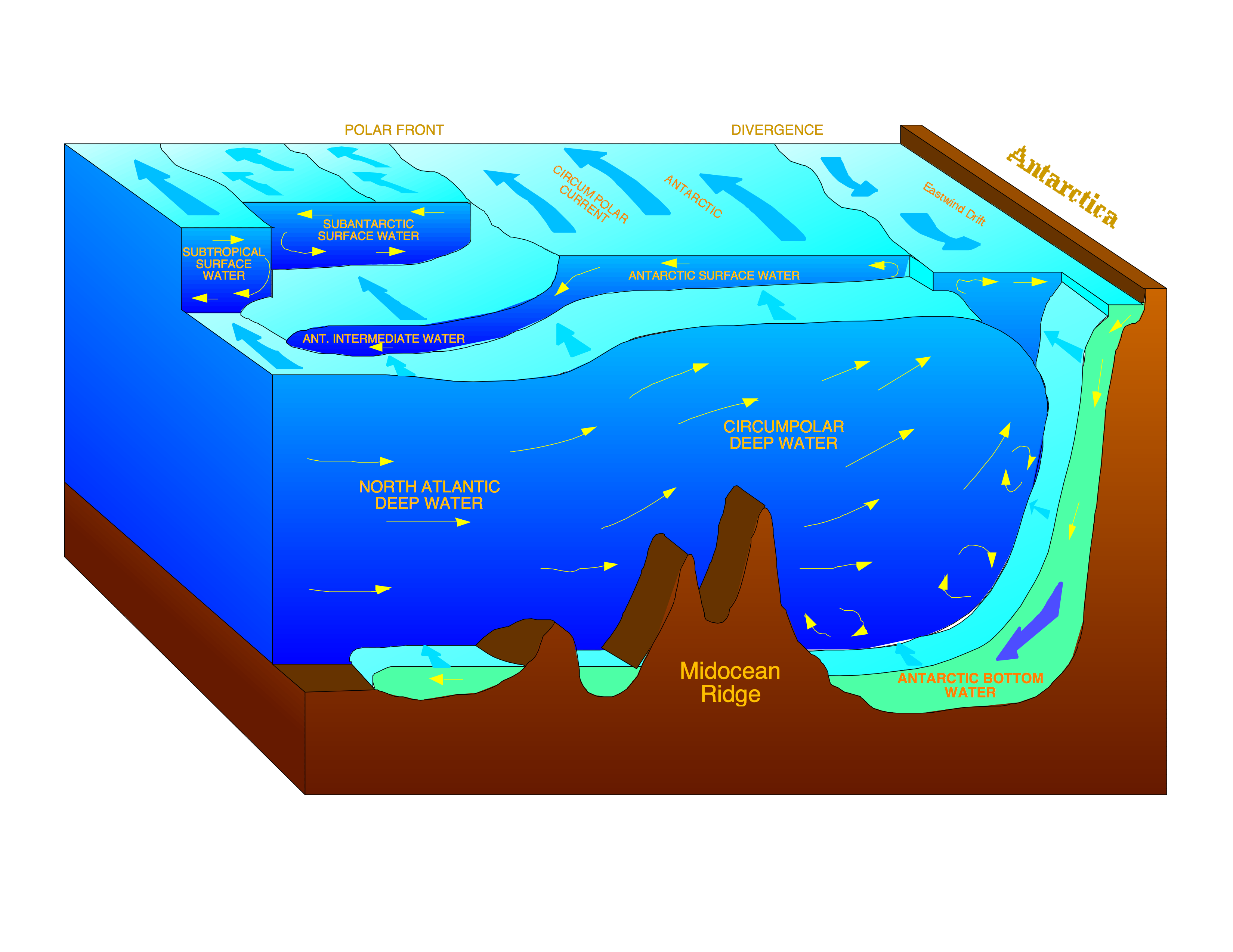
In the South tropical Atlantic water vapour is removed and dumped into the Antarctic circumpolar current via the domiant winds of the area. However, there is also an input of Indian Ocean Water around the southern rim of Africa that adds more salt to the equation. This Indian Ocean water influx is referred to as the Algulhas Leakage and it stems from the Alguhas current, which basically dumps some saltwater into the southern edge of the Atlantic Ocean from the Indian Ocean.

Ocean currents....kinda cool stuff.

Friday, September 26, 2008

Canadian Whale Institute


I didn't know we had a whale institute. I guess that is what I get for being born away from the ocean.
Here's the link: